

Quick answer
Area 51 from Las Vegas directions begin with I-15 North to US-93, then NV-375 (the Extraterrestrial Highway) toward Rachel, Nevada. The drive covers approximately 130 miles and takes two and a half to three hours under normal conditions. The facility itself is closed to the public, surrounded by restricted zones monitored by security patrols, motion sensors, and warning signage at multiple perimeters.
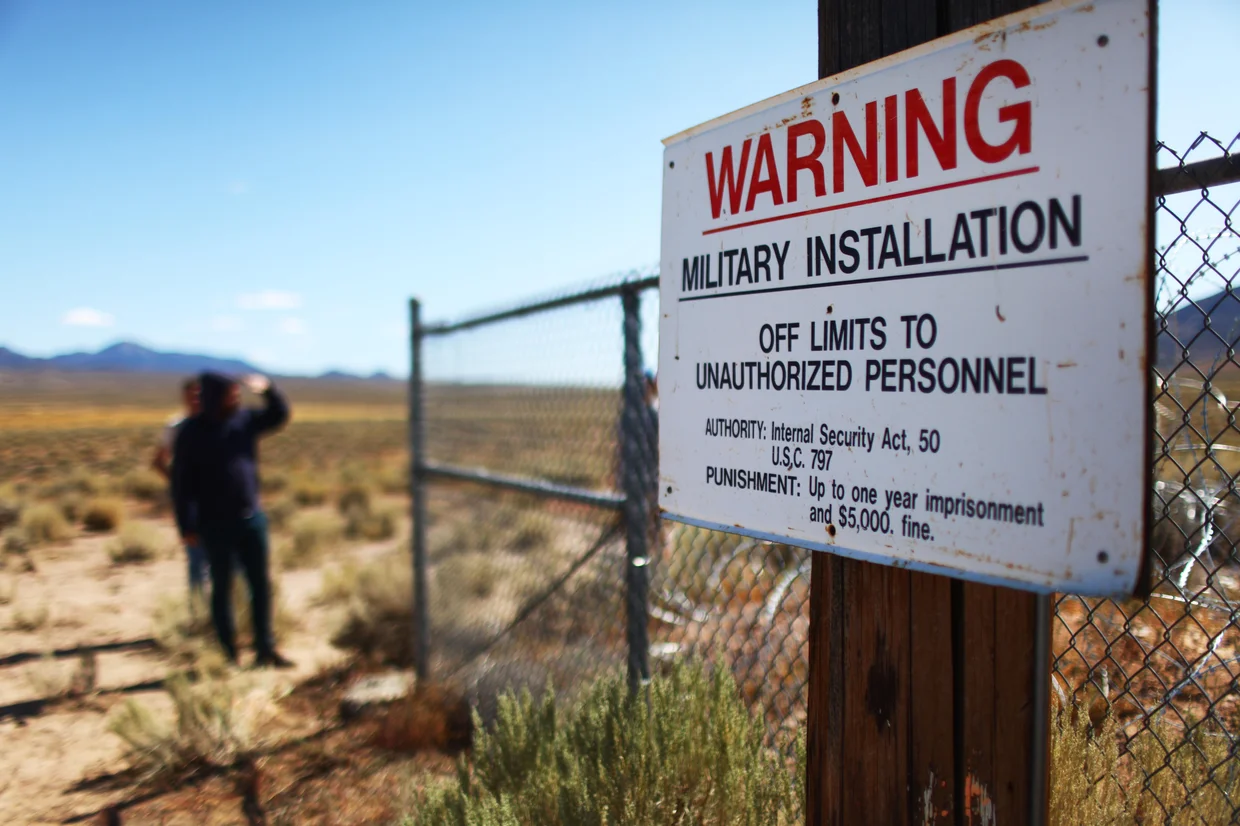
The Groom Lake facility occupies a remote basin in the Nevada Test and Training Range, a landscape so vast and featureless that even experienced desert drivers have difficulty gauging distance or identifying landmarks. The installation's restricted boundary extends miles beyond the actual base perimeter, creating a buffer zone where civilian vehicles are monitored, photographed, and intercepted by private security contractors working under Air Force authorization. The most common route from Las Vegas to the area follows I-15 North for approximately 85 miles, exiting onto US-93 toward Alamo, then turning west onto NV-375 near the Ash Springs junction. This two-lane highway cuts through Lincoln County, passing the small community of Rachel before reaching the nearest publicly accessible viewpoints. The Extraterrestrial Highway designation attracts casual tourists, but the road itself offers no services between Alamo and Tonopah—no fuel, no water, no cellular coverage for long stretches. Summer temperatures regularly exceed 105 degrees Fahrenheit, and winter conditions can bring ice, snow, and sudden closures. The closest legal vantage points lie along Groom Lake Road and the eastern ridgelines near Tikaboo Peak, both requiring high-clearance vehicles and off-pavement navigation. Groom Lake Road is paved for the first few miles, then transitions to graded dirt before reaching the security gate at the facility's southern boundary. White pickup trucks with tinted windows patrol this road around the clock, and crossing the marked boundary—identified by orange posts and warning signs—triggers an immediate response from Lincoln County Sheriff deputies, who issue federal trespassing citations starting at $1,000. The restricted airspace above the installation is equally enforced, with military aircraft authorized to intercept civilian drones and helicopters. Most visitors underestimate the logistical demands of independent travel to the region. The absence of infrastructure means carrying sufficient fuel, water, and emergency supplies, along with navigation equipment that functions without cellular data. The military's surveillance network detects vehicles miles before they reach any restricted boundary, and security personnel have legal authority to detain and question individuals who approach too closely or behave suspiciously. Guided tours from Las Vegas eliminate these risks by providing experienced drivers, pre-cleared routes, and real-time updates on security activity, allowing visitors to focus on the landscape and history rather than navigation and compliance. The route itself passes through some of Nevada's most isolated terrain, where the only markers are Joshua trees, dry lakebeds, and the occasional ranch. Rachel, population fewer than 50, serves as the informal gateway to the area, offering a small diner, a motel, and a gift shop stocked with conspiracy-themed merchandise. The town sits 25 miles from the nearest restricted boundary, making it a staging point for both independent travelers and commercial tour groups. The lack of alternative routes means that anyone traveling to the region uses the same highway, the same turn-offs, and the same dirt roads, all of which are monitored by the same security apparatus that guards the facility itself.
“The restricted boundary extends miles beyond the actual base perimeter, creating a buffer zone where civilian vehicles are monitored, photographed, and intercepted by private security contractors.”
Area 51 From Las Vegas Directions and Navigation Reality
Area 51 is located at Groom Lake, Nevada, USA. There is no public road access to the facility, but visitors typically travel from Las Vegas toward the town of Rachel to view the perimeter.
State Route 375 (Extraterrestrial Highway) to Rachel, NV
Various departure points via specialized transport
Best Time and Weather Considerations for Area 51 From Las Vegas Directions
The spring and autumn months offer the safest window for desert travel between Las Vegas and the perimeter of the restricted area. These seasons mitigate the extreme thermal risks associated with navigating remote Nevada highways.
March to May
LowMild temperatures, 60°F–80°F
Moderate daytime temperatures reduce the risk of vehicle overheating during long stretches. Spring provides clear visibility for driving desert routes.
June to August
LowSevere heat, 100°F–115°F
Summer months pose significant hazards due to extreme desert heat and potential for mechanical failure. Daylight travel is necessary to navigate unpaved sections safely.
September to November
LowCooler air, 65°F–85°F
Autumn weather is stable and favorable for extended driving through remote areas. These months allow for safer navigation before winter temperatures drop significantly.
Verdict: Mid-spring or mid-autumn are the preferred times for travel to ensure manageable weather conditions and safer desert road navigation.
Common Mistakes When Planning Area 51 From Las Vegas Directions
The distance from Las Vegas makes it easy to underestimate the risks of exploring on your own. Two mistakes put travelers in serious danger or legal trouble.
Driving past warning signs into restricted areas
Security patrols monitor the perimeter actively. Stop at the Extraterrestrial Highway viewpoints and photograph the gate from public land only—crossing into restricted zones can result in detention and federal charges.
Assuming cell service and fuel stations exist nearby
The nearest fuel is in Rachel or Alamo, and cell coverage disappears past Highway 375. Fill your tank in Las Vegas, carry extra water, and tell someone your route before leaving.
Treating the desert heat as manageable without preparation
Summer temperatures exceed 110°F, and dehydration can become critical within hours. Bring at least one gallon of water per person, sunscreen, and a hat—breakdown assistance can take hours to arrive.
Expecting public access or tour entry to the base
Area 51 is a restricted military installation with no visitor center or legal entry point. Guided tours stop at perimeter landmarks and the Little A'Le'Inn in Rachel, not inside the facility.
Admission Status for Area 51 From Las Vegas Directions
Area 51 is a restricted military installation, and there is no public access or admission fee for entry. The facility is closed to the public at all times.
Individuals pay 0 USD to access the site because it is a restricted military installation that does not permit public entry.
Operational Status and Hours for Area 51 From Las Vegas Directions
Area 51 is a restricted military installation and is not open to the public at any time. There are no operational hours for visitors.
| Monday | Closed | Restricted facility |
|---|---|---|
| Tuesday | Closed | Restricted facility |
| Wednesday | Closed | Restricted facility |
| Thursday | Closed | Restricted facility |
| Friday | Closed | Restricted facility |
| Saturday | Closed | Restricted facility |
| Sunday | Closed | Restricted facility |
Check availability
Frequently Asked Questions About Area 51 From Las Vegas Directions
Everything you need to know about area 51 from las vegas directions